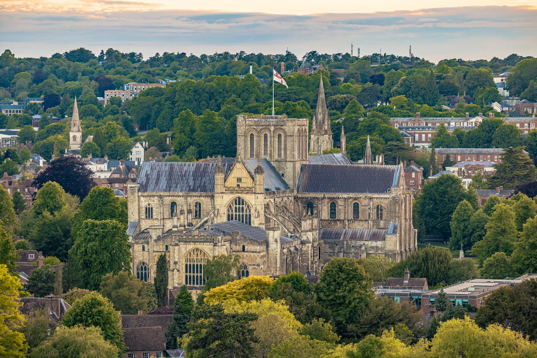
Winchester sits in a chalk valley with the River Itchen running through it — one of the finest chalk streams in the world, clear and weed-fringed and full of trout — and hills on both sides. The South Downs National Park begins at the eastern edge of the city, and the South Downs Way starts here and runs a hundred miles to Eastbourne.
That gives an unusual amount of walking for a city of fifty thousand, and almost all of it starts from the middle of town.
Distances are from the cathedral.
The best walk in Winchester and the one to do first. From the cathedral, through the Close and past Winchester College, out along College Walk and onto the water meadows, following the Itchen south for two kilometres to the Hospital of St Cross.
St Cross is a medieval almshouse founded in 1136 — the oldest charitable institution in England still functioning — with a Norman church, a quadrangle, a brethren still in residence, and the Wayfarer’s Dole: a horn of ale and a morsel of bread, given to any traveller who asks at the porter’s lodge, as it has been for eight hundred years.
John Keats walked this route daily in the autumn of 1819 and wrote To Autumn after one of them — “season of mists and mellow fruitfulness” is this water meadow in September. There is a marked Keats Walk following it.
An hour and a half round trip, level, and the finest short walk in Hampshire.
Two kilometres south-east, and the city’s hill: a chalk down rising steeply above the Itchen, crowned by an Iron Age hillfort, with a mizmaze cut into the turf near the summit — a turf labyrinth of uncertain but considerable age, one of only a handful surviving in England.
It is a 43-hectare Site of Special Scientific Interest owned by Winchester College, exceptional for chalk flowers and butterflies, and the view over the city with the cathedral in the middle of it is the one everybody photographs.
Forty-five minutes up from the water meadows, with a steep flight of steps. See our St Catherine’s Hill page.
Immediately east of the city centre, ten minutes’ walk up from the Broadway. A public park on a chalk spur with a viewpoint looking straight down onto the cathedral and the High Street. Shorter and easier than St Catherine’s, and the best five-minute view in Winchester.
A 64-hectare wetland reserve managed by the Hampshire and Isle of Wight Wildlife Trust, and — remarkably — it starts about four hundred metres from the High Street. Boardwalks and paths run through reedbed, wet grassland and carr woodland beside the Itchen, with kingfishers, water voles and, in summer, warblers.
Free, level, and one of very few nature reserves of this quality inside a city.
The Itchen Navigation, an eighteenth-century canalised waterway, runs south from Winchester towards Southampton beside the river. The towpath is a level walking route, passing St Cross and continuing through the water meadows to Shawford and Eastleigh — about twenty kilometres in total, with trains back from several points.
North, the Itchen Way runs up the valley through Kings Worthy, Itchen Abbas and Ovington towards Alresford, through some of the most-fished chalk stream in England.
The city walk takes about ninety minutes and covers most of two thousand years: the cathedral and its close, Winchester College, Wolvesey Castle — the ruined Norman bishop’s palace — the city walls along the eastern side, the King’s Gate with its church above it, the Great Hall at the top of the High Street, the Westgate, the Buttercross and the City Mill on the river.
All of it is within a kilometre and most of it is free to look at.
Eight kilometres west, a country park of chalk downland and beech woods with the Farley Mount monument — a pyramid on a barrow, erected to commemorate a horse that fell into a chalk pit, survived, and won a race the following year under the name “Beware Chalk Pit”. It is that sort of monument.
There are waymarked walks and a Roman road running through.
Eighteen kilometres south-east, and despite the name it is not near Winchester at all — it is a chalk hill in the South Downs above Meonstoke, carrying an Iron Age hillfort and a Bronze Age barrow cemetery, and it is a national nature reserve with exceptional chalk grassland flora, orchids and butterflies.
The view from the top runs to the Isle of Wight. It is one of the best short walks in the South Downs. See our Old Winchester Hill page.
The national trail starts in Winchester and runs 160 kilometres east along the chalk to Eastbourne. The first section, out over Cheesefoot Head and Beacon Hill towards Exton, is fine open downland walking, and there are buses back from the Meon valley.
Twenty kilometres west, National Trust chalk downland above the River Test — the other great Hampshire chalk stream — and the pretty town of Stockbridge below it.
Trains run to Southampton, Basingstoke, London Waterloo and, with a change, most of Hampshire, which makes linear walks along the Itchen straightforward.
Buses serve the Meon valley for Old Winchester Hill and the villages north and west.
The water meadows flood in winter and the paths can be under water — they are meadows, and they are meant to.
Chalk is slippery when wet, particularly on the steps up St Catherine’s Hill.
Winchester College and the cathedral close are private in parts; the public routes are signed.
Spring brings the water meadows into their best condition and the chalk downland into flower — the orchids on Old Winchester Hill and St Catherine’s Hill start in May.
Summer is when the Itchen is at its clearest and the trout are visible from every bridge, and when the South Downs Way is busiest with people walking to Eastbourne.
Autumn is the Keats season, and it is not a marketing invention: the mist over the water meadows on a September morning, the mellow fruitfulness of the valley, is precisely the walk he took. Late September and October here are exceptional.
Winter floods the water meadows, which is what they are designed to do — they were deliberately irrigated in the seventeenth century to bring on early grass — and the paths may be under water. The chalk hills are at their clearest and the city looks its best from St Giles Hill on a cold bright day.
Worth understanding, because it is the reason this valley looks the way it does. The Itchen is a chalk stream, and there are only around two hundred of them in the world, the great majority in southern England. Rain filters through chalk rather than running off it, emerging through springs at a constant temperature and with extraordinary clarity.
The result is a river that runs gin-clear over gravel and weed all year, full of wild brown trout, mayfly and water crowfoot, with kingfishers, water voles and otters along it. It is one of the rarest habitats in Britain and Winchester is built on it.
The fishing on the Itchen and the neighbouring Test is famous, expensive and largely private — but looking at the water from the public paths costs nothing and is one of the pleasures of walking here.
The Keats walk to St Cross and back through the water meadows — an hour and a half, level, and the best short walk in Hampshire.
A horn of ale and a morsel of bread given to any traveller who asks at the Hospital of St Cross. It has been offered since the twelfth century and still is.
About forty-five minutes up from the water meadows, with a steep flight of steps, and the best view of the city from the top.
In Winchester, running 160 kilometres east to Eastbourne.
No, despite the name — it is eighteen kilometres south-east in the Meon valley, and it is a national nature reserve with an Iron Age hillfort on it.