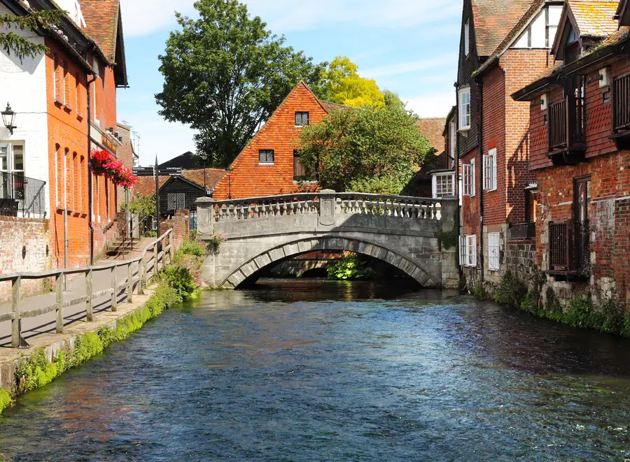
Winchester is built on a chalk stream. That is not a poetic way of saying there is a river in it. The Itchen is one of a handful of true chalk streams on earth — rain that has soaked through chalk and come out as springs, running clear over gravel at a near-constant temperature. There are only around two hundred of them anywhere, most of them in southern England. You can see trout from the bridges.
This is the river as a place, not a duplicate of the Keats walk. That walk is the classic, and you should do it. What follows is the water itself: mill, wildlife, reserve, walls, meadows.
Rain on the downs does not run off. It sinks, travels through the chalk, and emerges already filtered, alkaline and cold. Water crowfoot grows in it. Mayfly hatch on it. Wild brown trout and grayling hold in it. Kingfishers, water voles and otters use it. That assemblage is one of the rarest habitats in Britain, and in Winchester it runs under the High Street.
The river splits. Through the city you are looking at the natural channel, old mill leats, and the carriers of a water-meadow system engineered from the seventeenth century to keep grass growing in winter. Visitors who like rivers spend a long time working out which is which. They are all the Itchen.
The fishing on the Itchen and the neighbouring Test is famous, expensive and largely private. Looking at the water from the public paths costs nothing.
Winchester City Mill sits on Bridge Street, fifty metres from the Alfred statue, and it is the place to start. A mill has stood on this site since at least Domesday; the present building is mid-eighteenth-century, National Trust, and — on the Trust’s own wording — a free-entry site. That is worth checking on the day, because Trust arrangements move.
What you will actually get depends on the works. A late-August 2026 snapshot had the mill room and café open around 10–16, with the mill race closed while the water wheel is replaced. Some areas shut for that project. Read the National Trust page before you count on the wheel, the race, or a milling demonstration. The café, the island garden, the bookshop and the otter cameras have been the reliable core while the wheel is out.
It is small. Forty-five minutes covers it. Volunteers will talk about the machinery in as much detail as you want.
There is no parking. Chesil Street multi-storey is the nearest council park; otherwise park and ride. Do not type the mill’s postcode into a satnav and expect a bay. Our parking guide is that decision. The South Downs Way starts at the door.
From the mill, the river runs south under the old city wall. The path along this stretch is called the Weirs: water on one side, flint on the other, the cathedral roof appearing over the wall to the west. It is the quiet side of the city, five minutes from the Broadway, and most people who only do the High Street never see it.
Wolvesey Castle sits on the inside of those walls — the ruined palace of the Bishops of Winchester, English Heritage, free, and open seasonally. The river is immediately behind it. Henry of Blois built most of what survives; Mary I and Philip of Spain held their wedding breakfast here after marrying in the cathedral. It is a ruin with good boards, and thirty minutes is enough. Check it is open; volunteers, not a ticket desk, decide some days.
Abbey Gardens sit the other way from the mill, between Alfred and the back of the cathedral, with the Itchen in channels through the lawns. Free, benches, a play area, and the sandwich spot in the city. Trout are visible from the bridges if you stand still.
The cathedral is a river building in disguise: the crypt floods because the water table is this high, and William Walker packed concrete under the east end because the Normans founded it on peat. You can see the problem from the Weirs. If you go in, our cathedral guide is the visit.
Four hundred metres from the High Street, at Durngate, the city stops and the wetland starts.
Winnall Moors is 64 hectares of chalk-stream water meadow managed by the Hampshire and Isle of Wight Wildlife Trust. Boardwalks and surfaced paths run a southern circuit of about a kilometre and a half — thirty to forty-five minutes if you do not linger. Reedbed, wet grassland, carr woodland, the river in several channels. Free.
This is one of very few nature reserves of this quality inside an English city, and it is almost always quieter than the Close. Kingfishers, water voles, little egrets, warblers in summer, snipe in winter. Otters are on the Itchen.
Winter flooding is not a defect. The meadows are meant to go under. After sustained rain the boardwalks can be the only dry line; the northern section is wilder with restricted access. Read the signs. Dogs are limited in parts of the reserve. On foot from the Broadway is the cleaner arrival.
South of the college the valley opens. Water meadows — hatches and carriers still visible — run toward the Hospital of St Cross, the twelfth-century almshouse that still gives the Wayfarer’s Dole to anyone who asks at the porter’s lodge. That walk is the Keats walk: level, about two kilometres each way from the Close, and covered properly in the walks guide. Do not skip it because you have already seen the mill. The mill is the city river; the meadows are the valley.
St Catherine’s Hill rises on the east bank, a chalk down with an Iron Age hillfort and a turf maze on the summit. The Itchen runs at its foot. From the towpath you can climb the steps — they are steep, and chalk is slick when wet — or continue south on the level. The hill is a different outing from St Giles Hill, which sits immediately east of the Broadway and is a city viewpoint, not a hillfort. See St Giles Hill if the photograph of the cathedral roofs is what you wanted.
The Itchen Navigation, the eighteenth-century canalised cut, continues south toward Shawford and Eastleigh. The towpath is a linear walk with trains back. That is a half-day, not an hour between the mill and lunch.
Otters are on this river, in the centre of a cathedral city. The mill runs cameras on the holt; live sightings happen, and the archive footage is the honest fallback. Dawn and dusk on the Weirs are better than midday. Kingfishers use the mill race, the Weirs and Winnall. Water voles are a Winnall speciality. Trout and grayling are visible from almost every crossing when the light is right. Do not assume you can fish.
Dragonflies in numbers from June to August at Winnall. Chalkhill and adonis blues on St Catherine’s Hill in the same months. The river and the down are one system.
The national trail starts at the City Mill and runs roughly a hundred miles east along the chalk to Eastbourne. The first hours are not a mountain walk. They are a city river, then the meadows, then the climb onto the downs at Cheesefoot Head.
You do not have to walk to Eastbourne. Walk the first section, stand on the hill, and come back on a bus from the Meon valley, or turn round at St Cross. The mill’s role as gateway is practical: maps, a café, a starting post, and a river already under your feet. National Cycle Route 23 also passes the mill.
Spring is when the meadows come up and the warblers come in. Summer is when the Itchen is at its clearest and the trout are obvious from every bridge. Autumn is the Keats season — mist over the meadows on a September morning is not a marketing invention. Winter floods the meadows, which is what they were designed to do. Paths go under; the boardwalks at Winnall earn their keep; the mill café is the indoor hour that still has the river in the window. See Winchester in the rain.
Start at the mill when it opens — check the Trust page for the wheel and the hours. Walk the Weirs to Wolvesey, then the Close if you want the building. Lunch in Abbey Gardens, on a bench over the channel. Afternoon either north to Winnall, which is almost in the High Street, or south onto the meadows toward St Cross, with St Catherine’s Hill as the climb if the legs want it. Do not try to do all of them as if they were adjacent rooms. They are one river. They are not one hour.
The car, if you brought one, stays at Chesil Street or at park and ride. The river is not a drive.